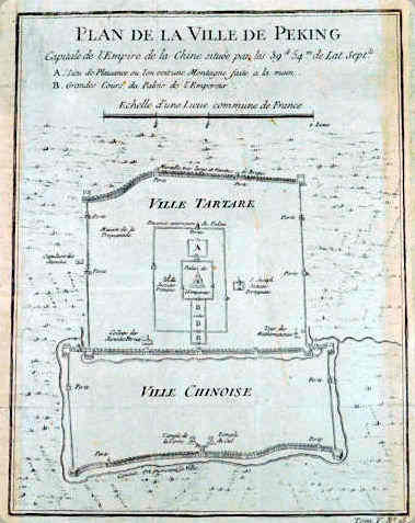
На французском языке внутренняя часть Запретного города Пекина называется "Вилла Тартара", татарский город.
 https://fr.wikipedia.org/wiki/Ville_tartare
In French, the inner part of Beijing's Forbidden City is called Ville Tartare, the Tartar city.
 Карта города Пекин. Map of Peking City.
Тартарская вилла, город татар (упрощенный китайский: 内城; традиционный китайский: 內城; пиньинь: Nèichéng; лит. "Внутренний город"), также известный как Монгольский город или Внутренний город (Пекина), является историческим районом Пекина в Китайской Народной Республике. Он простирается вокруг Императорского города и включает в себя площадь Тяньаньмэнь и Угольный холм, а также Колокольню и Барабанную башню. Город татар имеет форму квадрата, выровненного по точкам компаса, и составляет около шести километров с каждой стороны. Его стены были разрушены в 1958 году.
Своим названием город обязан монголам, затем маньчжурам (турко-монголы и тунгусы, частью которых являются маньчжуры, прозванные на Западе татарами), обосновавшимся в Ханбалыке (ныне Пекин) во время воцарения династии Юань. Этот город был отнят монголами у кидани, которые сделали его своей южной столицей (называвшейся тогда по-китайски Нанкин, буквально столица Юга, или Яньцзин, 燕京, буквально столица ласточек).
Они отстроили город вокруг Императорского города, который со времен маньчжурской династии Цин включал Запретный город, обнесенную стеной центральную часть города. К югу от Запретного города был разбит второй город, где поселилось китайское население, окруженный другими стенами, который с тех пор назывался китайским городом. С 1990-х годов город татар подвергся масштабной реконструкции и обновлению, и несколько традиционных районов (хутонг) теперь остались только в северной части города татар, возле озер и двух традиционных башен, в восточной части, между Запретным городом и Ванфуцзин, и, наконец, в южной части, к югу от площади Тяньаньмэнь.
Внешние стены и ворота были в основном разрушены, освободив место для больших бульваров (вторая кольцевая дорога Пекина), основные перекрестки которых, как и в Париже для кольцевой дороги, сохранили названия бывших ворот. Вторая линия пекинского метрополитена проходит по маршруту старых внешних стен города тартаров, как и вторая кольцевая дорога.
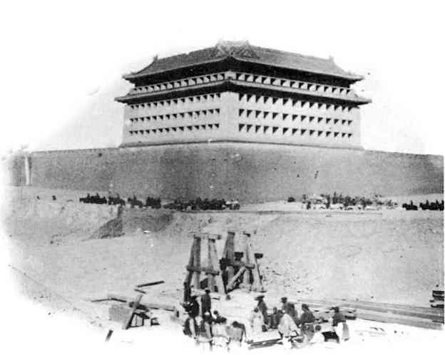
 Строительство инженерных сооружений для прокладки железной дороги через городской ров Тартара. Большая башня, возвышающаяся над стеной, в принципе, была предназначена для размещения нескольких огневых этажей, но в действительности ее многочисленные амбразуры закрыты деревянными ставнями, на каждой из которых нарисовано устье пушки.
Construction of an engineering structure for the passage of the railway over the Tartar city moat. The large tower on top of the wall was, in principle, intended to house several floors of fire, but in reality its numerous embrasures are closed by wooden shutters on each of which is painted the mouth of a cannon.La Ville Tartare, Tartar City (simplified Chinese: 内城; traditional Chinese: 內城; pinyin: Nèichéng; lit. "Inner City"), also known as Mongolian City or Inner City (of Beijing), is a historic district of Beijing in the People's Republic of China. It extends around the Imperial City and includes Tian'anmen Square and Coal Hill, as well as the Bell Tower and the Drum Tower. The Tartar City is shaped like a square aligned with the points of the compass and measures about six kilometres on each side. Its walls were demolished in 1958.
It owes its name to the Mongols, then to the Manchus (the Turco-Mongols and Tungus, of which the Manchus are part, being nicknamed in the West the Tartars) established in Khanbalik, now Beijing, during the accession of the Yuan dynasty. This city was taken from the Khitans, who had made it their southern capital (named then in Chinese Nanjing, literally capital of the South or Yanjing (燕京, literally capital of the swallows)), by the Mongols.
They rebuilt the city around the Imperial City, which since the Manchu Qing Dynasty has included the Forbidden City, the walled central part of the city. To the south of the Forbidden City, a second city was developed where the Chinese population settled, surrounded by other walls and which was from then on called the Chinese City. Since the 1990s, the Tartar City has undergone major reconstruction and renovation, and the few traditional districts (hutong) now remain only in the northern part of the Tartar City, near the lakes and the two traditional towers, in the eastern part, between the Forbidden City and Wangfujing, and finally in the southern part, south of Tian'anmen Square.
Most of the outer walls and gates have been destroyed, making way for large boulevards (Beijing's second ring road), whose major intersections have, as in Paris for the ring road, kept the names of the former gates. Line 2 of the Beijing metro follows the route of the old outer walls of the Tartar City, as does the second ring road.
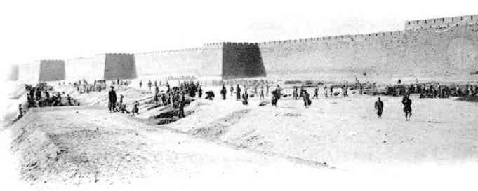
 Набережная во рву татарского города.
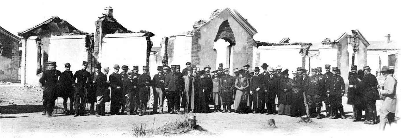
Execution of an embankment in the ditch of the Tartar city. Главнокомандующий, министры Франции, Бельгии и другие гости на торжественном открытии железной дороги Лу-Ку-Кяо в Пекине, среди развалин мастерских Чан-Син-Тянь.
The General Commander-in-Chief, the Ministers of France and Belgium and the guests at the inauguration of the Lou-Kou-Kiao railway, in Peking, amidst the ruins of the Chan-Sin-Tien workshops.#
asia #
beijing #
china #
french #
past #
revision #
tartaria #
tatar #
timespace