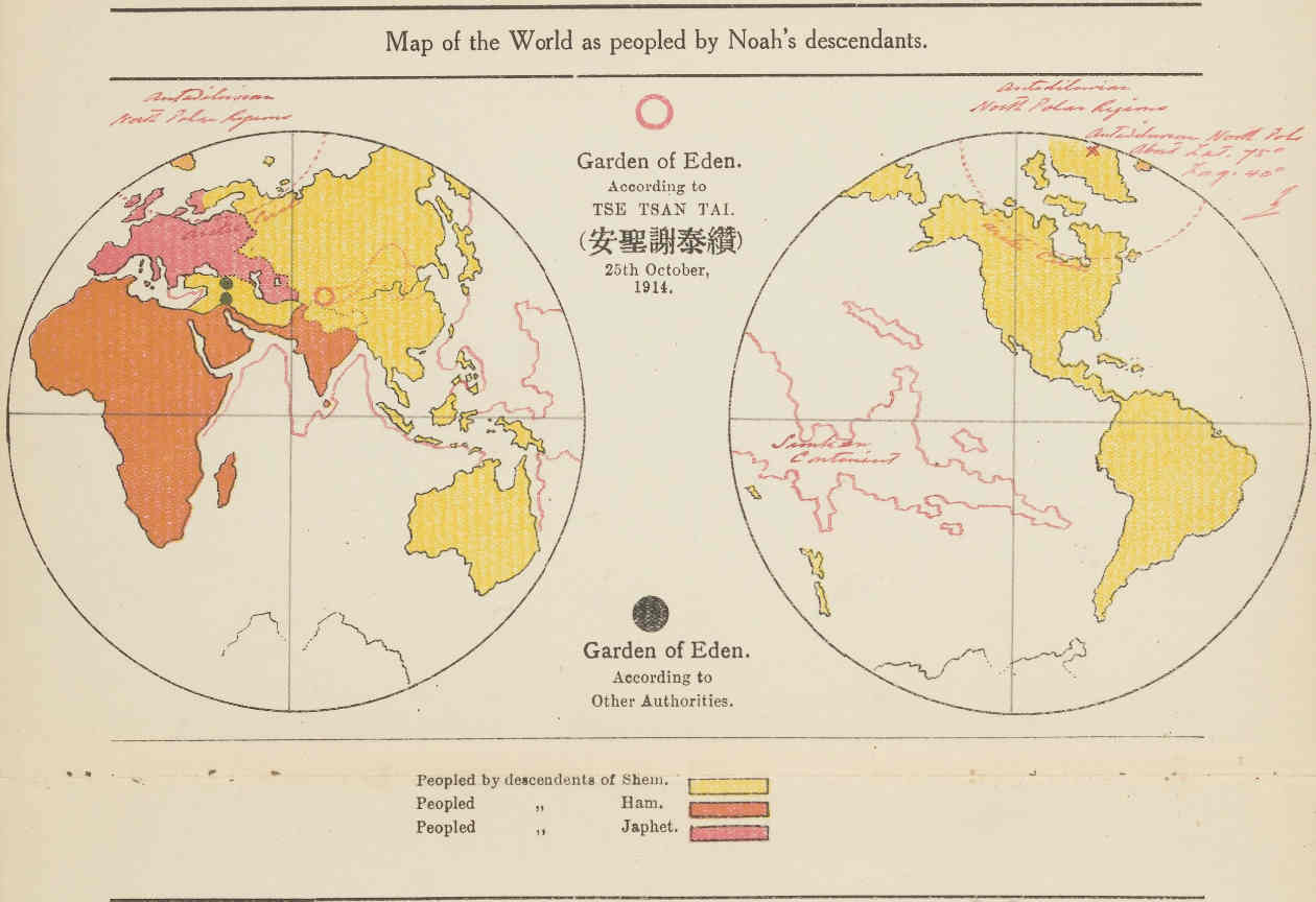
About 100 years ago, the book "
Creation; the real situation of Eden, and the origin of the Chinese" by the Chinese Australian writer
Tse Tsan Tai contained two noteworthy chapters "The Chinese Record of the Deluge" and "The Change in the Position of the North Pole". These chapters describe the change in the position of the North Pole due to the flooding of many previously inhabited areas.
The Harvard Library has a special copy, with the author's additions to the printed copy (red handwritten text).
 http://nrs.harvard.edu/urn-3:FHCL:13614580
Около 100 лет назад в книге "
Сотворение; реальное положение Эдема, и происхождение китайцев" австралийско-китайского писателя
Цэ Цань Тая содержалось две примечательные главы "Китайская летопись потопа" и "Изменение положения Северного полюса". В этих главах описывается изменение положения Северного полюса в связи с затоплением многих ранее заселенных территорий.
В Гарвардской библиотеке имеется специальный экземпляр с дополнениями автора к серийному печатному экземпляру (красный рукописный текст).
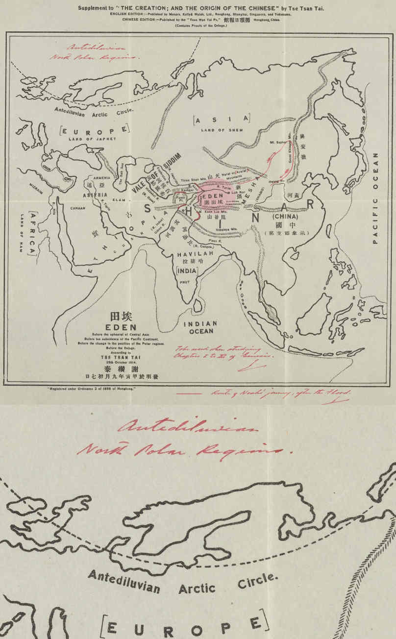
The "Antediluvian Arctic Circle" is marked here. On the next map, it is clearly visible that in this model by Tse Tsan Tai - the Antediluvian North Pole was in Greenland.
Здесь отмечен "Допотопный арктический круг". На следующей карте хорошо заметно, что в этой модели Цэ Цань Тая - допотопный северный полюс был в Гренландии.
#
antediluvian #
catastrophism #
climatechange #
flood #
harvard #
maps #
northpole #
orientation #
past #
pole #
revision #
time #
weather


