In
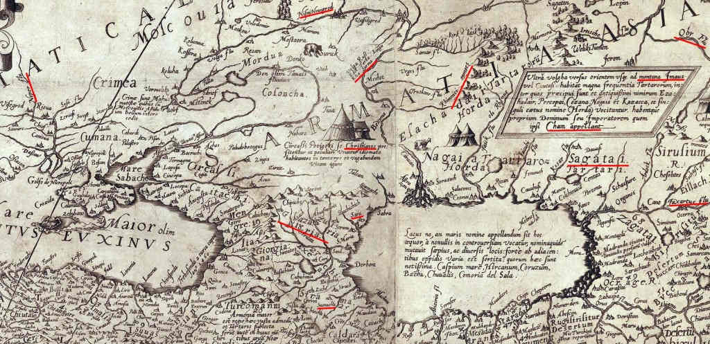
the previous publication, i probably incorrectly translated the name of the map. The word "Czarienne" i translated as "tsarist". But if we take into account the fact that in Dutch “Khazar Khaganate” is written as “Rijk der Chazaren” (sounds like “Reich der Chazarin”), then it is likely that 300 years ago the word “Czarienne” could be translated as “Khazar”. Interestingly, the Dutch have indicated the Turkish name for this historical entity: Hazar İmparatorluğu, which sounds like "Khazar Imperatorlyug".
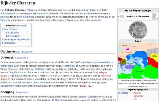
https://nl.wikipedia.org/wiki/Rijk_der_Chazaren
I would also like to note that in Wikipedia about the author of this French-Dutch map there is an article only in the Ukrainian language:
https://uk.wikipedia.org/wiki/Анрі_Шателен
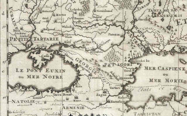
And it is not surprising, because on this map there is one of the earliest mentions of the region with the name "Uсraine".
So who was this Henri?
A fantasy cartographer or mystifier who pointed out on map the states and cities that did not exist in his time?
Or deliberately forgotten master of cartography, retained rare reliable evidence of the political map of the world in 1720?
Let me remind you that on this map dated by 1720, in addition to the region of Ucraine there also indicates the capital of the Khazar - Samandar.
У попередній публікації, ймовірно, неправильно переклав назву карти. Слово «Czarienne» переклав як «царський». Але якщо враховувати те, що голландською «Хозарський каганат» пишеться як «Rijk der Chazaren» (звучить як «Рейх дер Чазарін»), то цілком імовірно, що 300 років тому слово «Czarienne» перекладалося як «Хозарський». Цікаво, що голландці вказали турецьку назву цього історичного утворення - Hazar İmparatorluğu, яке звучить як "Хазар Імпараторлюг".
Також хотілося б звернути увагу, що у Вікіпедії про автора цієї французько-голландської мапи є стаття тільки українською мовою:
https://uk.wikipedia.org/wiki/Анрі_Шателен
І це не дивно, адже на цій мапі є одна з найбільш ранніх згадок регіону з назвою «Uсraine».
Так хто ж такий був цей Анрі?
Фентезі-картограф чи містифікатор, який вказував на актуальній мапі держави і міста, що не існували за його часу?
Або навмисно забутий майстер картографії, що зберіг рідкісні достовірні свідчення про політичну мапу світу в 1720 році?
Нагадаю, на цій мапі, що датована 1720 роком, крім регіону України також вказана столиця Хозар - Самандар.
#
asia #
europe #
french #
dutch #
hoax #
khazar #
maps #
memory #
metaprogramming #
past #
property #
reich #
reichism #
revision #
timespace #
stan #
ukraine